Showing posts with label Map. Show all posts

Friday, 5 October 2018

Hamilton joins the Blogosphere


We are pleased to share that the Diocese of Hamilton Library & Archives launched a blog last week, with a post entitled, A little bit about “our shelves…”

And nothing - we mean nothing - warms our hearts like a punny title.

Congratulations to the team at the Bishop Farrell Library & Archives! We look forward to following you.

It's been five years since this impressive repository opened its renovated facilities next to Cathedral Basilica of Christ the King. It's worth a visit - both online and on-site.

***

Toronto and Hamilton dioceses have a special relationship, being part of the same ecclesiastical province. In the Catholic Church, a province consists of a metropolitan archdiocese and one or more suffragan dioceses headed by diocesan bishops. Toronto is the metropolitan see of the ecclesiastical province of the Archdiocese of Toronto, which is why our ordinary is called an archbishop. Hamilton, along with London, St. Catharines and Thunder Bay are the suffragan dioceses. The insignia of a metropolitan archbishop is the pallium.

Dioceses comprising a province are usually close geographically, often ceding territory to each other as new dioceses are erected and elevated. The Diocese of Toronto was created by the division of the Diocese of Kingston in 1841. Toronto was divided in 1856 by the erection of the dioceses of Hamilton and London, and again in 1958 with the created of the Diocese of St. Catharines. 


Boundaries of the See of Toronto over time. Graphic created for the 175th anniversary of the Archdiocese of Toronto in 2016.

The dioceses of Toronto and Hamilton have shared a border since 1856.


One of the responsibilities of the metropolitan archbishop is to call and preside over provincial councils. These assemblies of bishops are held to discuss ecclesiastical affairs and enact disciplinary regulations for the province. Toronto was a suffragan diocese of Québec until it was raised to an archdiocese in 1870. After being elevated to archbishop, Most Rev. John Joseph Lynch of Toronto called the First Provincial Council in 1875, which included Bishop Crinnon of Hamilton, Bishop Walsh of London, Bishop Jamot of Peterborough, and Bishop Duhamel of Ottawa. In the 1880s, both Ottawa and Kingston were elevated to metropolitan sees and provinces shifted accordingly.  

Photographs Special Collection, PH 04/10P

Photograph labelled "Fathers and Theologians of the first R.C. Prov. Council at Toronto, 1875."

Participants of the First Provincial Council of the Archdiocese of Toronto, seated in front of St. Michael's Cathedral Basilica, Toronto. Seated, left to right: Bishop Crinnon, second bishop of Hamilton; Bishop Walsh, London; Archbishop Lynch, Toronto; Bishop Jamot, Peterborough; Bishop Duhamel, Ottawa. Toronto was raised to a metropolitan see in 1870, making Lynch an archbishop. The four other bishops represented the suffragan dioceses comprising the province at that time. In the 1880s, both Ottawa and Kingston were elevated to metropolitan sees and provinces shifted accordingly. The suffragan dioceses are currently Hamilton, London, St. Catharines and Thunder Bay.


Bringing the focus back to Hamilton, we offer a great photograph from our holdings of the episcopal ordination of Most. Rev. Joseph Ryan, the sixth and longest serving bishop of the Diocese of Hamilton. 

And now we'll leave the blogging about Hamilton to our Hamiltonian colleagues!

Photographs Special Collection, PH 35R/08P

Group photograph on the steps of Christ the King Cathedral Basilica, Hamilton, at the episcopal ordination of Bishop Ryan of Hamilton, 19 October 1937. Front row episcopacy (wearing mitres) from left: Bishop Joseph A. O'Sullivan of Charlottetown and Bishop John T. Kidd of London (principal co-consecrators); Bishop Joseph F. Ryan: Archbishop John T. McNally of Halifax (principal consecrator). Archbishop James McGuigan of Toronto is right of Archbishop McNally.


Friday, 24 February 2017

The Quest for the Map of Canada

It seems difficult to remember what we did before GPS and Google Maps. We can put the globe in our pockets, but before smartphones and computers, people relied on paper maps to see the world.

The history of the map of Canada starts with Indigenous peoples, but the first known European map of Canada dates to the early 1500s. At the time, cartographers seem to have believed that Eastern Canada and Greenland were part of Asia. Techniques were vastly improved over the next century, and Samuel de Champlain made great strides, mapping as far west as Georgian Bay.

By the time the Diocese of Toronto existed, cartography and publishing were vastly different. Maps were available for common people to own. Here in the archives, we have a great example of a map of Upper and Lower Canada that could have been kept on a bookshelf as a handy reference tool. At first, it looks like any other book:

ARCAT Holograph Collection

HO 02.009

But when you look inside, something is a bit different:

ARCAT Holograph Collection

HO 02.009

After unfolding several layers, the map is fully opened:

ARCAT Holograph Collection

HO 02.009

Though the map is undated, it appears that it was published by Charles Magnus some time after he moved to New York in the 1840s and some time before Canadian confederation in 1867:

ARCAT Holograph Collection

HO 02.009

ARCAT Holograph Collection

HO 02.009

Google Maps might have a lot of useful features, but it doesn't have this kind of flair!

ARCAT Holograph Collection

HO 02.009

A fun decorative detail:

ARCAT Holograph Collection

HO 02.009

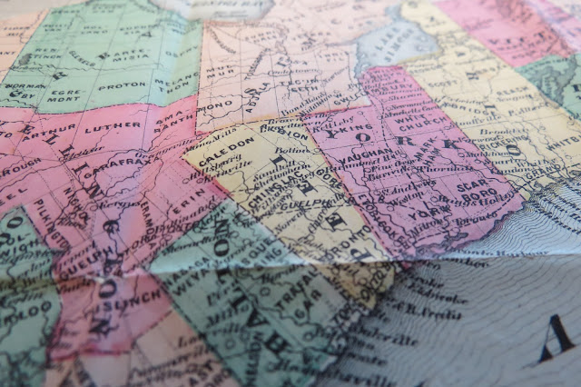
And here's our own little corner of Upper Canada:

ARCAT Holograph Collection

HO 02.009

Think about these kinds of maps when your GPS voice is telling you to turn right on Bloor! For a great history of the mapping of Canada, check out the Canadian Encyclopedia. To see more maps of Canada, check out McGill University's W. H. Pugsley Collection of Early Canadian Maps.